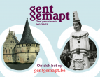
GhentCDH proudly presents Ghent Mapped. The digital city map Gent Gemapt stacks 20 historical maps and connects them to 4,000 places and 10,000 pieces of heritage. Collections and history that over time have become dispersed among museums, libraries, archives, associations and living rooms, come together again virtually. Reunited, they offer a multifaceted view of the city and its past. Go explore for yourself via gentgemapt.be and discover Ghent layer by layer, from the Middle Ages to today.
The cultural heritage project Gent Gemapt is a collaboration of Ghent University Library, STAM - Stadsmuseum Gent, Huis van Alijn, Industriemuseum, Archief Gent, Amsab-Institute for Social History, Liberas and Erfgoedcel Gent. It was developed and coordinated by the Ghent Centre for Digital Humanities at Ghent University.
Contact: fien.danniau@ugent.be
Want to know more?
- "De Kaart" is the core of Ghent Gemapt. It is an innovative presentation platform that spatially unlocks the splendor of Ghent's heritage collections. It allows you to search, zoom and scroll through time and space of the city.
- "Gent Verrijkt" stands next to De Kaart and is the digital toolbox of Gent Gemapt. Here, museums and archives enlist the help of volunteers to help transcribe, date, describe and identify their collections.
- With the project, the heritage partners are innovating in digital technology. Gent Gemapt uses open source technology Omeka S, Madoc, IIIF (International Image Interoperability Framework), Linked Open Data, and a new Ghent place register.
- Gent Gemapt is funded through a project grant from the Department of Culture, Youth and Media of the Flemish Government and through Clariah-Vlaanderen.
- After this launch, Gent Gemapt continues to grow and the partners continue to build on the heritage presentation and enrichment via GentGemapt.be.
- Read About Gent Gemapt and About the project.
